Resplendent Ladies, Extraordinary Gentlemen, Genderqueer Adventurers, Behold:
Maps & Atlases
so, yeah, its a band.
Its where cartophiles and math-rock geeks come together. The video this kid made (below) is just a loop of our old friend Beaker being cuckoo-bananas, which is funny at first, but you’re better off paying attention to the crazy music and scrolling along while you listen…
Okay, and to pair up the music with some snippets of Atlases:
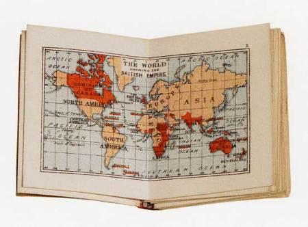
Here’s a map of the British Empire, like, all once-upon-a-time and junk:
 ps, the folks at cartophilia claim its the smallest atlas in the world.
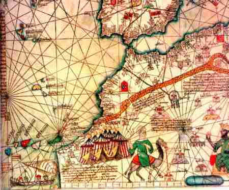
but that scheme is hella euro-centric. how about this guy:

Ibn Battuta (1305 – 1369?)
Ibn Battuta was perhaps the greatest traveler of the Middle Ages, having traveled about 75,000 miles in 29 years! He is especially important to history because of his written accounts (reports) of his travels. From these records we can learn about the cultures that he visited. The book about his travels is the only historical source of information about many of the places he visited which included the East African coast, the Empire of Mali in West Africa, Arabia, Iraq, Iran, Turkey, India, China, Spain, and many, many more! As a Muslim, he took advantage of the generosity shown to pilgrims and travelers in the Empire. He was often given gifts (of horses, gold, and even slaves) and stayed for free in dormitories, private homes, and even in the palaces of Muslim rulers. For seven years he worked for the Sultan in Delhi, India. On his travels he met several Sultans who welcomed him into their company. His descriptions are filled with adventures – he almost died several times. He survived robbers, shipwrecks, pirates, wars, and the Black Death (or Bubonic Plague).
… and that concludes our history lesson for the day.
but there’s still math to be reckoned with! according to this NYT op ed
The mathematics of cities was launched in 1949 when George Zipf, a linguist working at Harvard, reported a striking regularity in the size distribution of cities. He noticed that if you tabulate the biggest cities in a given country and rank them according to their populations, the largest city is always about twice as big as the second largest, and three times as big as the third largest, and so on. In other words, the population of a city is, to a good approximation, inversely proportional to its rank. Why this should be true, no one knows.
okay. that pretty much blows my mind.
I’ll leave you with this clip of Dave Davison (of Maps & Atlases) making crazy sexy love to a guitar like you prolly haven’t ever seen before.
Man, I wish I knew how to make that kind of crazy sexy love…
The Maps, the Rock, and the Blimey British Empire are Yrs,
Sunshine Superboy
oh. speaking of Black Atlases, and my recent addition to 30 Rock (seriously you guys, I’m obsessed. and Tina Fey is the most charming woman on the planet)…
